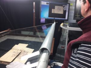
large format maps, we are currently digitising approximately 630,000 pages of field books for the North Island, with some of them dating back to 1872. The field books are small and very fragile landscape bound notebooks, our digitisation process involves a Digital SLR-based camera and custom built copy boards which fully supports the book while using glass to gently hold the pages flat.
The purpose of digitising these books is to ensure LINZ continues a high quality service to their customers by providing land information and past measurements. Given the ongoing use of the information in these books, the age and fragility puts them at some risk of permanent loss of information. Our busy Wellington team has been gently digitising each of the 13,000 field books over the past 4 months, in an effort to make the information more accessible and of more use to surveyors and researchers.
“Throughout this digitisation project we are lucky to find the occasional drawing and doodle in some books, which are a nice surprise for our operators and helps bring to life the human touch of the field books.”We have captured small sketches in the corner of pages through to beautifully detailed drawings of landscapes or buildings that may have been drawn to help represent the area that was being surveyed. Or perhaps they are the result of a tired surveyor resting after a long hike. By digitising these books we are capturing all the fine detail of the recorded measurements and are thrilled to see the past come back to life from each individual field book. Not only drawings have been discovered, but the extra special surprises such as a four leaf clover, pressed flowers and toadstools, and a perfume card that still holds its scent. It lets us take a look back and imagine the events of the past and what the surveyor was observing all those years ago. [metaslider id=360] To access some of the recorded data and you can request the files from the LINZ website here.